
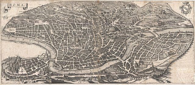
The City in Decline: Rome in Late Antiquity
The City in Decline: Rome in Late Antiquity By Kevin Twine Middle States Geographer, Vol.25 (1992) Abstract: This paper addresses the question of what happens…
Why Republican Rome was a ‘smart city’
The authors describe Rome prior to Republican Times as a smart city because its expansion did not substantially alter the natural features of the area, and natural resources were managed to minimize environmental risks.
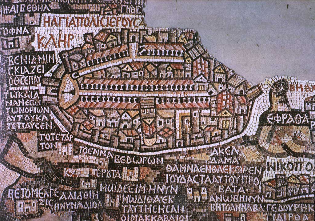
Transformation of a City: The Christianization of Jerusalem in the Fourth Century
Jerusalem was a backwater in the Roman Empire by the beginning of the fourth century CE, with nothing left of its former first-century splendour.
Roman Businesswomen. I: The case of the producers and distributors of garum in Pompeii
This paper is intended to be a beginning of a series of texts about the economic activity of women in Rome.
Republics between hegemony and empire: How ancient city-states built empires and the USA doesn’t (anymore)
This paper discusses the concepts ‘empire’ and ‘hegemony’, provides a new model of the institutional structure of ancient ‘citizen-city-state empires’, and argues that the contemporary USA cannot be defined as an ‘empire’.
The shape of the Roman world
‘ORBIS: The Stanford Geospatial Network Model of the Roman World’ simulates the time and price costs of travel by land, river and sea across the mature imperial transportation network, notionally approximating conditions around 200 CE. In the version used for this paper, the model links some 750 sites (mostly cities but also some landmarks such as passes and promontories) by means of c.85,000 kilometers of Roman roads selected to represent the principal arterial connections throughout the empire.
The Subsidiary Temple of Nekhtnebef at Tell el-Balamun
The subsidiary temple constructed by Nekhtnebef (Nectanebo I) as a barque-station on the cross-axis of the Amun-Temple at Tell el-Balamun has been the subject of excavation during various seasons of excavation at the site by the British Museum, most recently in Spring 2004. The accumulated understanding of the monument gained through this work is now sufficient to present some conclusions on its design and how it compares with other temples of the period.
The Fall and Decline of the Roman Urban Mind
In this chapter we argue that, in spite of the fascination with Rome as the caput mundi
Kushite buildings at Kawa
A number of temples, other religious monuments and houses were excavated at Kawa in the 1920s and 1930s by the Oxford Excavation Committee. The current survey and excavation project by the Sudan Archaeological Research Society has been recording many additional buildings of the early Kushite period, some of which are presented in this article.